
Sources for Gainesville Neighbors by Block
The official sources around a Gainesville address are complementary. Hall County GIS supplies geometry and context; qPublic joins assessment and sales information to individual parcels; recorded deeds and plats clarify ownership and subdivision identity; city NPU maps show planning boundaries; older numerical directories reveal historical household names. None alone answers who every nearby person is. The useful result is a parcel-by-parcel map with dated evidence and explicit unknowns.
| Block source | Best use near an address | Limits and access |
|---|---|---|
| Hall GIS Viewer Experience | Parcel boundaries, streets, buildings, subdivision lots, city limits, zoning, and flood context | Free map; exact select and buffer controls remain unverified |
| Hall qPublic | Owner, mailing and situs addresses, assessment and sales tied to a parcel | County says weekly updates; owner does not equal occupant |
| Recorded deeds and plats | Prior owners and lot, block, or subdivision identity | GSCCCA access or Hall clerk counter and copies |
| Bradford-Ridgewood and Fair Street NPU maps | Planning-unit boundaries over named streets and parcels | Free city maps; no member roster |
| 1947 Baldwin numerical directory | Historical householders, phones, and ownership marks in house-number order | Digital Library of Georgia; verify OCR against page images |
A tax record proves what the roll says about an assessed parcel at its update date. It does not name every person living there. Hall County's returned-mail extract visibly separates property address, owner mailing address, owner name, legal description, and homestead. That structure is a warning against merging fields into a household claim. Nearby residents may include people who never appear as owners, and an owner may receive mail somewhere else.
Owner Rolls Miss Most Gainesville Households
Only 39.2 percent of occupied Gainesville homes were owner-occupied in the ACS profile recorded by the research. That number makes the owner-versus-resident distinction more than a technical caution: a parcel-owner list is an incomplete proxy for nearby people. Homestead coding can support an owner-occupancy inference in some circumstances, but no code establishes every household member, and the absence of a code does not explain who lives at the site.
Keep two columns. Record “owner shown on parcel roll” separately from “occupant supported by a dated directory or schedule.” If the second column has no reliable source, leave it unknown.
Map Gainesville Neighbors Parcel by Parcel
The county confirms parcels and street centerlines as layers in the Hall GIS Viewer Experience. Search the anchor address, zoom until parcel boundaries and buildings are distinct, then work around the block in a consistent direction. Subdivision-lot and city-limit layers help define what belongs in the immediate search. The research could not observe the live JavaScript viewer's exact click, select, radius, buffer, measure, or qPublic-link controls, so those mechanics should be learned from the interface rather than guessed.
- Open the Hall GIS Viewer Experience and locate the anchor address.
- Set a block rule before collecting names: touching parcels, both sides between two intersections, or a clearly described subdivision segment.
- Move parcel by parcel in map order and record each parcel number, situs, and contextual layers without assuming household identity.
- Check each parcel in qPublic for the dated owner and mailing fields, keeping the assessment source separate from the map.
- Use deeds or plats when a lot boundary, prior owner, or subdivision description needs documentary confirmation.
A full named-street project has a different scope. The Gainesville directory by street carries that longer address chain; the method here stays focused on the immediate block.
Zoning and Flood Layers Define the Block
The county gateway distinguishes qPublic's parcel, assessment, sales, aerial, zoning, and contour information from the broader GIS Experience. The Experience includes subdivision lots, flood zones, utilities, public-safety, election, and future-land-use context. Those layers can explain why parcels that look close on a postal map belong to different subdivisions, jurisdictions, or planning areas. They describe geography and public administration, not personal characteristics.
City limits deserve special attention. A Gainesville postal address may be inside the city, in unincorporated Hall County, or near another municipality. City Planning maintains Gainesville mapping and handles annexations and zoning verification; Hall GIS supplies the countywide context. For a disputed city line, contact Gainesville Community and Economic Development at 311 Henry Ward Way, 770-531-6570, rather than inferring jurisdiction from the postal city.
Two Gainesville NPUs Are Maps, Not Rosters
Gainesville publishes official maps for the Bradford-Ridgewood and Fair Street Neighborhood Planning Units. The Bradford-Ridgewood map visibly overlays its boundary on labeled streets and parcel lines. City planning documents also identify the Fair Street Area NPU Vision, Goals and Objectives Statement from 2008 and the Bradford-Ridgewood statement from 2010, with concerns that include pedestrian safety, property maintenance, and neighborhood improvements.
| Community point | Publicly documented use | Contact or caution |
|---|---|---|
| Bradford-Ridgewood NPU | Official mapped planning boundary and city-led vision work | No official public membership directory found |
| Fair Street Area NPU | Official planning area and vision statement | Boundary is not proof of association membership |
| Fair Street Neighborhood Center | Civic facility serving the area | 715 Fair Street; 770-531-2680 |
| Neighborhood Watch | Police Department organizing packet and crime-prevention guidance | No watch-member roster is published |
The absence of a citywide official association directory is a real research gap. Public boundaries, officers, facilities, and meeting notices can support local orientation, but private membership should not be reverse-engineered from property or voter data.
A Gainesville Business Layer Near the Block
The Greater Hall Chamber member directory adds a public commercial and civic layer without pretending to identify households. Its interface supports a keyword prompt, category choices, a ZIP field, and result entries that may show an organization, category, phone, website, and sometimes an address. The directory reported 1,205 results when inspected, making it useful for recognizing services and institutions near a block.
The Greater Hall Chamber directory interface shows how the local search begins.
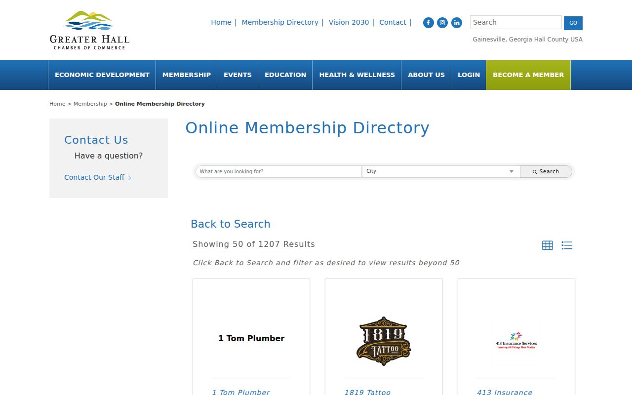
Results belong in a nearby-places layer, not a household list. An organization address and telephone number identify a public-facing entity, while the block's private residents remain a separate question.
Official Block Records Versus Search Sites
Official records. Parcel maps, assessment rolls, deeds, plats, and city planning maps disclose a named field for a defined public purpose. They carry custodians, dates, and geographic keys that let a reader verify the result.
Commercial compilations. Commercial lookup products may blend old addresses and unverified associations without showing the underlying update cycle. Treat any result as a lead and return to the official record that could support the claim.
Accuracy comes from matching the question to the source. Use GIS for geometry, qPublic for parcel fields, deeds for recorded transfers, NPU maps for planning geography, and a historical numerical directory for a dated past household. No compilation should erase those distinctions.
Privacy Limits on a Gainesville Block
Georgia's protections are record-specific. Safe at Home, enacted in 2024 and codified at O.C.G.A. § 50-18-150 et seq., supplies eligible participants with a substitute public-record address, mail forwarding, and a sealed confidential voter address. Open-record exemptions protect specified personal identity information, birth certificates are nonpublic, sealed court material remains restricted, and motor-vehicle personal information falls under federal law. “Public record” never means that every field is public.
Georgia's My Voter Page is a self-lookup tool, not a route for assembling the block. State voter lists use prescribed paid datasets and statutory fields; protected information and ballot choice are outside a lawful neighbor map. Utility, delivery, private association, and watch membership likewise should not be inferred. If a public field is masked, the correct response is to respect the protection, not search for a workaround.
Use block information lawfully. Research about nearby residents can support civic curiosity, local orientation, reconnection, or personal safety awareness. Never use addresses or names to watch, intimidate, harass, or harm anyone.